What it Takes
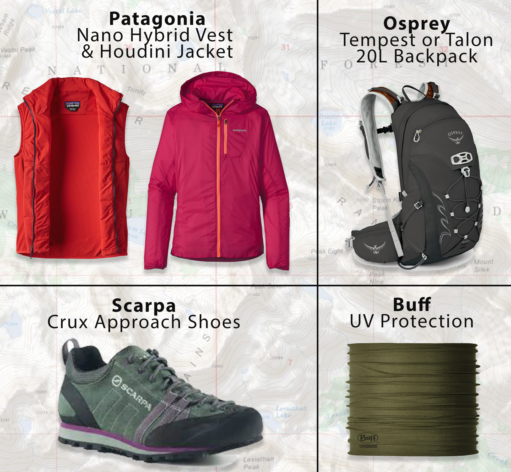
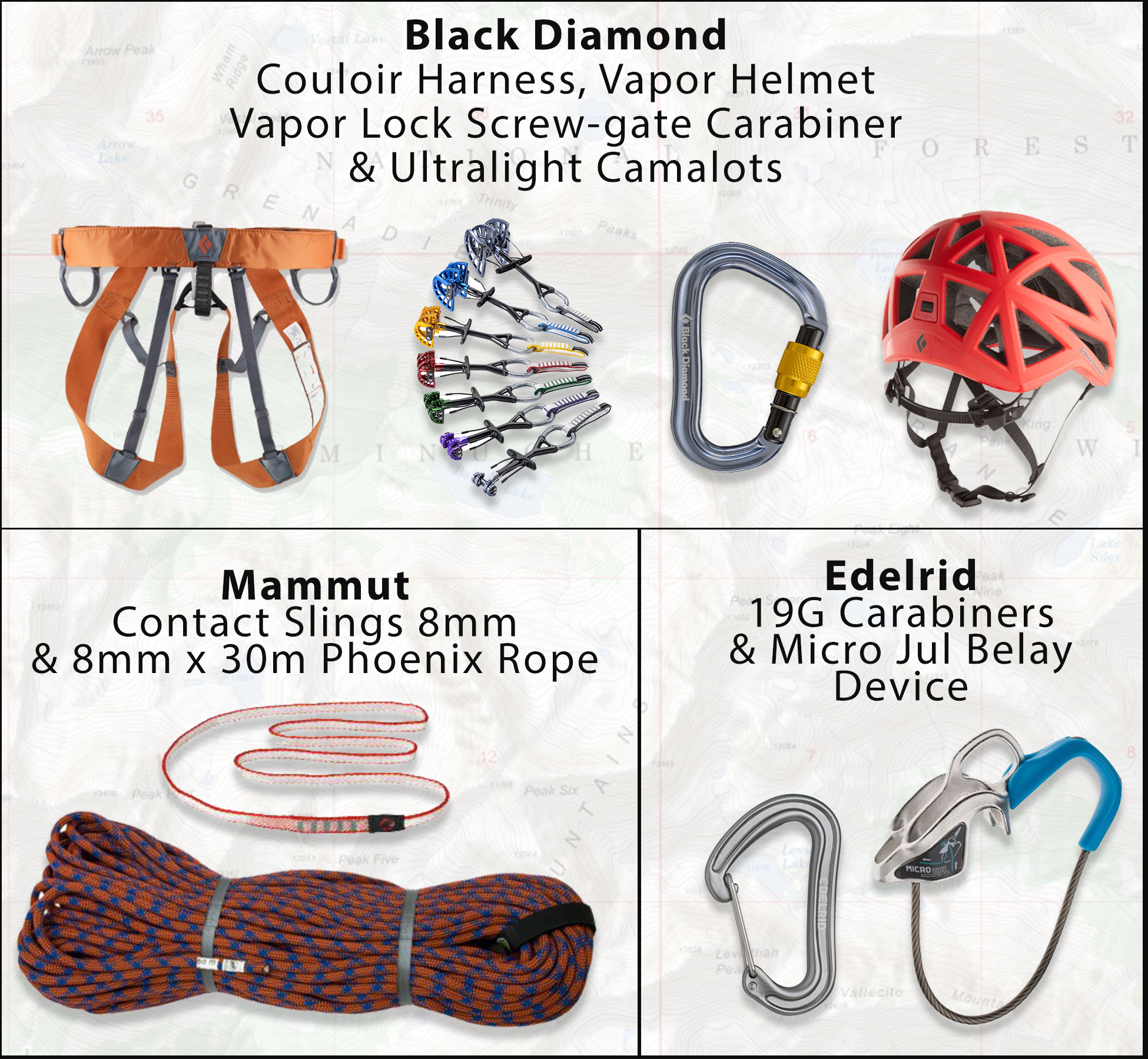
The high country is officially accessible on foot! Stop by & check out our peak- bagging essentials at Pine Needle Mountaineering. We've got a great selection of apparel, backpacks, maps, water-filtration, trekking poles, headlamps, and lightweight climbing gear.
Vestal Peak, 13,864'

A mountain goat poses below Vestal Peak's (13, 864') Wham Ridge. Photo by Steve Eginoire
This beautiful peak is located in the heart of the San Juan Mountain's Grenadier Range.
A lofty mass of billion-year-old quartzite, Vestal is a classic example of the heavily glaciated terrain that defines this area of the Weminuche Wilderness.
Vestal Peak's signature feature is known as the Wham Ridge, a dramatic sweep of polished stone comprising the entire NE face of the mountain. Clearly labeled on most maps, Wham Ridge is a gorgeous climb and a perfect objective for those looking to hone in basic alpine rock climbing skills.
Getting There
From Molas Pass Trailhead (665), descend to the Animas River, and locate Elk Creek Trail (503) a few hundred yards south of the bridge. 3.5 miles
Follow Elk Creek Trail (503) for 3.5 miles to a few large beaver ponds just upstream of the Vestal Creek drainage. Keep an eye out for moose!
At the eastern end of the main pond, locate a well-worn trail heading south through the woods and down into Elk Creek.
Find a good place to cross the creek, and follow the established trail up Vestal Creek for a steep 2 miles until reaching the large meadow/marsh area directly below Vestal and Arrow Peak.
Locate a nice cascading stream above the south side of the meadow. A faint trail can be found on climber's right of the stream that eventually gains a high bench at the base of Vestal and Arrow peaks.
The most straight-forward route up Wham Ridge can be found on the climber's right side of the face, near the ridge proper. Expect to encounter difficulties up to 5.4, but there are many options to choose your own adventure throughout the face.
To descend, drop directly off of the summit onto the south face. Carefully scramble down loose 3rd-4th class gullies and ledges, aiming for the saddle in between Vestal and Arrow. From the saddle, descend steep scree and onto the moraines that lead back to Vestal Basin. Don't forget to jump in the lake!
Topo Map of Grenadier Range
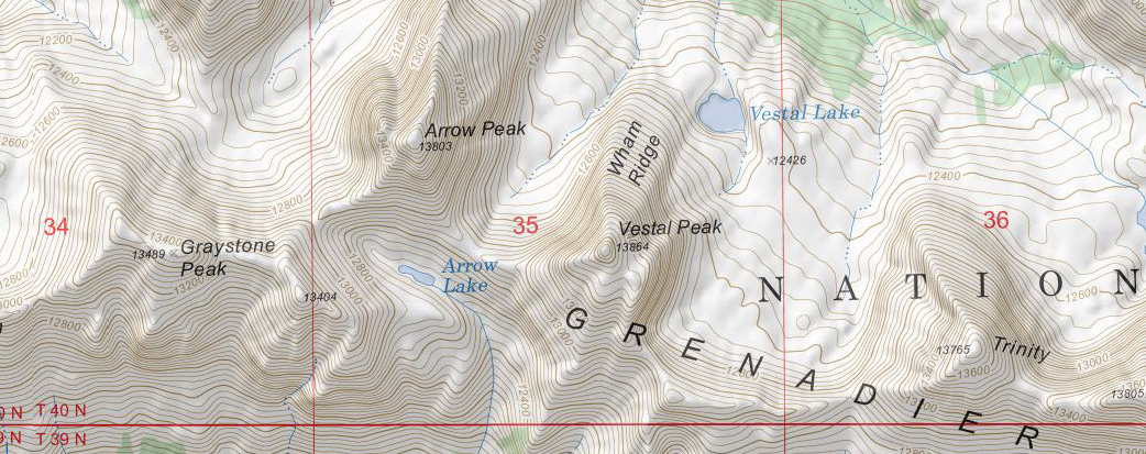
Just look at those contour lines!